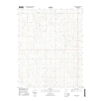
2016 Map of Shattuck NW
USGS Topo · Published 2016About this map
Catesby anchors this portion of northwestern Ellis County, a landscape defined by its section-line roads and the intermittent drainage of the southern High Plains. The settlement is located in the northern reaches of the sheet, situated near the headwaters of Dry Prong. To the south, the terrain is carved by the meandering courses of Six Pony Cr and Ivanhoe Cr, which reveal the underlying topography of this rural region. The map preserves the locations of local landmarks that are vital for genealogical research, including the Bickford Cem near the northern boundary and Mount Hope Cem further south. This 2016 survey illustrates the persistent grid of county roads, such as e0400 RD and NS 174, which have historically facilitated the movement of livestock and agricultural goods through this Oklahoma panhandle borderland.
Find a feature on this map
33 named features on this map. Tap any name to fly to it.
Don’t see what you’re looking for? This feature index may not catch every label — zoom into the map to look around manually.
Map Details
Editions of this 2016 Shattuck NW Map
This is the sole edition of this map. No revisions or reprints were ever made.
Other maps of this area

1954 · Perryton
USGS Topo · 1:250,000

1955 · Woodward
USGS Topo · 1:250,000

1958 · Perryton
USGS Topo · 1:250,000

1958 · Woodward
USGS Topo · 1:250,000

1969 · Shattuck
USGS Topo · 1:24,000

1969 · Shattuck NW
USGS Topo · 1:24,000

1969 · Gage
USGS Topo · 1:24,000

1969 · Shattuck NE
USGS Topo · 1:24,000

1970 · Laverne SW
USGS Topo · 1:24,000

1971 · Slapout
USGS Topo · 1:24,000