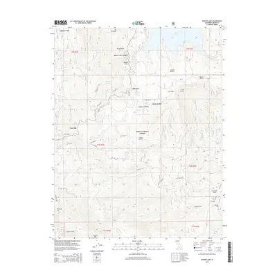
2015 Map of Shaver Lake
USGS Topo · Published 2015About this map
Shaver Lake dominates the northern reaches of this Sierra Nevada landscape, a high-altitude reservoir surrounded by 21st-century resort settlements and historic timber sites. The map documents the legacy of the local lumber industry through the presence of Mathews Mill and Old Bretz Mill, indicating the long-term economic transitions of this portion of the Sierra National Forest. Moving south from the shoreline communities of Shaver Lake Heights and Dora Belle, the terrain drops toward Pineridge and the drainage of Jose Cr. Local transit is defined by winding mountain routes like Bretz Mill Rd and Big Creek Rd, which connect remote outposts such as Ockenden and Sierra Nevada. The southern portion of the sheet transitions into deep drainages and ridges, including Blue Canyon and Soaproot Flat, illustrating the varied topography of Fresno County.
Find a feature on this map
45 named features on this map. Tap any name to fly to it.
Don’t see what you’re looking for? This feature index may not catch every label — zoom into the map to look around manually.
Map Details
Editions of this 2015 Shaver Lake Map
This is the sole edition of this map. No revisions or reprints were ever made.
Other maps of this area

1904 · Kaiser
USGS Topo · 1:125,000

1922 · Trimmer
USGS Topo · 1:96,000

1924 · Dinuba
USGS Topo · 1:125,000

1942 · Watts Valley
USGS Topo · 1:62,500

1944 · Watts Valley
USGS Topo · 1:62,500

1947 · Mariposa
USGS Topo · 1:250,000

1948 · Fresno
USGS Topo · 1:250,000

1948 · Mariposa
USGS Topo · 1:250,000

1952 · Patterson Mountain
USGS Topo · 1:62,500

1953 · Huntington Lake
USGS Topo · 1:62,500