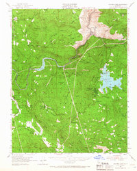
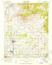
1953 Map of Shaver Lake
USGS Topo · Published 1966About this map
The San Joaquin River carves a deep path through this mid-century landscape of the Sierra Nevada, defining the boundary between Madera and Fresno counties. The map documents an area defined by early hydroelectric development and mountain industry, centered on Shaver Lake and its surrounding infrastructure. Notable for local history, the sheet identifies several remote institutions including the Wish-I-Ah Sanatorium and the North Fork Indian Mission, alongside established settlements like Auberry and Tollhouse. Industrial relics and active facilities are scattered throughout, from the San Joaquin Mines to the hydroelectric Powerhouse 2 and Powerhouse 4. Movement through the terrain is traced along the historic Mammoth Road and various old railroad grades, reflecting the transition from timber extraction at sites like Old Bretz Mill to the recreational and utility-focused landscape emerging around Shaver Lake Heights.
Find a feature on this map
88 named features on this map. Tap any name to fly to it.
Don’t see what you’re looking for? This feature index may not catch every label — zoom into the map to look around manually.
Map Details
Editions of this 1953 Shaver Lake Map
5 editions found

Other maps of this area

1904 · Kaiser
USGS Topo · 1:125,000

1912 · Mariposa
USGS Topo · 1:125,000

1922 · Trimmer
USGS Topo · 1:96,000

1923 · Academy
USGS Topo · 1:31,680

1924 · Dinuba
USGS Topo · 1:125,000

1942 · Watts Valley
USGS Topo · 1:62,500

1942 · Millerton Lake
USGS Topo · 1:62,500

1944 · Watts Valley
USGS Topo · 1:62,500

1945 · Millerton Lake
USGS Topo · 1:62,500
1946 · Clovis
USGS Topo · 1:62,500