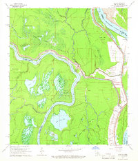
1965 Map of Shaw
USGS Topo · Published 1966About this map
The confluence of the Red River and the Mississippi River dominates this mid-1960s landscape, illustrating a complex hydrologic environment where the Concordia and Avoyelles Parish lines follow the shifting paths of the water. The map documents an extensive network of bayous and wetlands, including the evocatively named Dismal Swamp and Whisky Bayou Lakes. The area's economic activity is clearly marked by the Union Point Oil Field and the Red River Bay Oil Field, showing how energy extraction integrated into the alluvial plains. Small riverfront communities like Union Point and Black Hawk are situated along the levee system, which serves as the primary infrastructure protecting these low-lying settlements. For genealogists, the map preserves the location of Cocodrie Ch and isolated rural structures that served the agricultural and industrial workers of the Mississippi Delta.
Find a feature on this map
53 named features on this map. Tap any name to fly to it.
Don’t see what you’re looking for? This feature index may not catch every label — zoom into the map to look around manually.
Map Details
Editions of this 1965 Shaw Map
3 editions found
Other maps of this area

1935 · Tooleys
USGS Topo · 1:62,500

1939 · Artonish
USGS Topo · 1:62,500

1939 · Deer Park
USGS Topo · 1:62,500

1941 · Voorhies
USGS Topo · 1:62,500

1941 · Tooleys
USGS Topo · 1:62,500

1953 · Natchez
USGS Topo · 1:250,000

1954 · Artonish
USGS Topo · 1:62,500

1955 · Artonish
USGS Topo · 1:62,500

1956 · Natchez
USGS Topo · 1:250,000

1958 · Artonish
USGS Topo · 1:62,500