
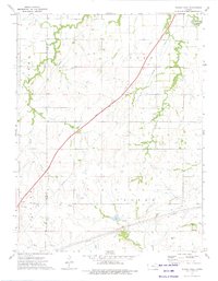
1973 Map of Shaw Creek
USGS Topo · Published 1975About this map
Kenbro sits at the southern edge of this landscape where the Verdigris River and North Branch Verdigris River meet near the border of Lyon and Greenwood counties. The area is defined by its drainage systems, including the namesake Shaw Creek, Rock Creek, and Wolf Creek, which carve through the Flint Hills terrain. In the early 1970s, the local economy was marked by small-scale petroleum extraction, evidenced by scattered Oil Wells and pipelines across the rural landscape. Administrative boundaries for Bazaar, Center, Field, and Madison provide a framework for understanding historical land use and local governance in this part of Kansas. The map captures the intersection of three counties—Chase, Lyon, and Greenwood—at a time when the region remained largely dedicated to ranching and energy production.
Find a feature on this map
16 named features on this map. Tap any name to fly to it.
Don’t see what you’re looking for? This feature index may not catch every label — zoom into the map to look around manually.
Map Details
Editions of this 1973 Shaw Creek Map
This is the sole edition of this map. No revisions or reprints were ever made.
Other maps of this area

1888 · Emporia
USGS Topo · 1:125,000

1894 · Emporia
USGS Topo · 1:125,000

1955 · Hutchinson
USGS Topo · 1:250,000

1959 · Hutchinson
USGS Topo · 1:250,000

1967 · Madison SW
USGS Topo · 1:24,000
1967 · Thrall
USGS Topo · 1:24,000
1967 · Teterville
USGS Topo · 1:24,000
1973 · Olpe
USGS Topo · 1:24,000
1973 · Gladstone
USGS Topo · 1:24,000
1973 · Phenis Creek
USGS Topo · 1:24,000