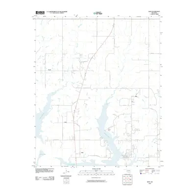
2010 Map of Shay
USGS Topo · Published 2010About this map
Lake Texoma dominates the southern landscape of Marshall County, where the rising waters of the mid-20th century transformed the regional geography into a series of peninsulas and deep inlets. This 2010 survey illustrates the modern shoreline where established communities like Willis and Fobb sit near the water's edge, linked by a network of local roads such as Willis Beach Rd and Fobb Bottom Rd. The map provides significant detail for local historians, showing the location of Shay Cemetery near the settlement of Shay, and the Texoma Christian Camp situated on a prominent point overlooking the lake. To the north, the land rises into creek-fed drainages like Buncombe Creek and Brier Creek, where small settlements such as Powell and Enos anchor the rural road network between the shoreline and the upland fields.
Find a feature on this map
33 named features on this map. Tap any name to fly to it.
Don’t see what you’re looking for? This feature index may not catch every label — zoom into the map to look around manually.
Map Details
Editions of this 2010 Shay Map
This is the sole edition of this map. No revisions or reprints were ever made.
Other maps of this area

1901 · Tishomingo
USGS Topo · 1:125,000

1901 · Denison
USGS Topo · 1:125,000

1954 · Sherman
USGS Topo · 1:250,000

1957 · Ardmore
USGS Topo · 1:250,000

1958 · Gordonville
USGS Topo · 1:62,500

1958 · Denison Dam
USGS Topo · 1:62,500

1958 · Sherman
USGS Topo · 1:250,000

1963 · Ardmore
USGS Topo · 1:250,000

1963 · Madill
USGS Topo · 1:24,000

1963 · Mc Millan
USGS Topo · 1:24,000