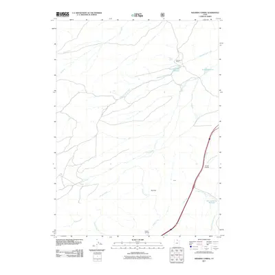
2011 Map of Shearing Corral
USGS Topo · Published 2011About this map
Shearing Corral and the small settlement of Curvo serve as the primary human markers in this high-elevation landscape of Summit County. The area's water management is evident through a series of reservoirs and drainage systems, including Shearing Corral Reservoir, Suttons Reservoir, and the Ball and Moore Reservoir in the southeast. These man-made features are vital components in a terrain defined by seasonal waterways like Shearing Corral Creek and Crane Creek.
Find a feature on this map
18 named features on this map. Tap any name to fly to it.
Don’t see what you’re looking for? This feature index may not catch every label — zoom into the map to look around manually.
Map Details
Editions of this 2011 Shearing Corral Map
This is the sole edition of this map. No revisions or reprints were ever made.
Other maps of this area

1954 · Ogden
USGS Topo · 1:250,000

1958 · Ogden
USGS Topo · 1:250,000

1960 · Ogden
USGS Topo · 1:250,000

1964 · Francis Canyon
USGS Topo · 1:24,000
1964 · Heiners Creek
USGS Topo · 1:24,000

1968 · Wahsatch
USGS Topo · 1:24,000
1968 · Porcupine Ridge
USGS Topo · 1:24,000

1968 · Shearing Corral
USGS Topo · 1:24,000

1968 · Mc Kay Hollow
USGS Topo · 1:24,000

1968 · Peck Canyon
USGS Topo · 1:24,000