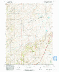
1991 Map of Shearing Corral
USGS Topo · Published 1991About this map
Cache National Forest dominates the western portion of this high-country landscape, where the borders of Rich, Morgan, and Summit counties converge. The terrain is defined by a series of north-south canyons and ridges, most notably Francis Canyon, Tristram Canyon, and the prominent Lake Ridge in the northwest. Water management for high-altitude grazing is evident through numerous named catchments like Shearing Corral Reservoir, Suttons Reservoir, and Ball and Moore Reservoir, alongside the namesake Shearing Corral itself.
Find a feature on this map
32 named features on this map. Tap any name to fly to it.
Don’t see what you’re looking for? This feature index may not catch every label — zoom into the map to look around manually.
Map Details
Editions of this 1991 Shearing Corral Map
This is the sole edition of this map. No revisions or reprints were ever made.
Other maps of this area

1954 · Ogden
USGS Topo · 1:250,000

1958 · Ogden
USGS Topo · 1:250,000

1960 · Ogden
USGS Topo · 1:250,000

1964 · Francis Canyon
USGS Topo · 1:24,000
1964 · Heiners Creek
USGS Topo · 1:24,000

1968 · Wahsatch
USGS Topo · 1:24,000
1968 · Porcupine Ridge
USGS Topo · 1:24,000

1968 · Shearing Corral
USGS Topo · 1:24,000

1968 · Mc Kay Hollow
USGS Topo · 1:24,000

1968 · Peck Canyon
USGS Topo · 1:24,000