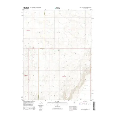
2014 Map of Sheep Creek Range NE
USGS Topo · Published 2014About this map
Sheep Creek Range dominates this portion of the Great Basin, where the high desert terrain transitions into the broad expanse of Boulder Valley. This 2014 survey captures the topographical character of the borderlands between Lander County and Eureka County, revealing a landscape defined by drainage patterns and elevation shifts rather than dense settlement. The presence of Boulder Cr in the southeastern corner provides a rare water feature in this arid environment, illustrating the natural focal points for historical land use and livestock movement in the region. The map meticulously documents the Public Land Survey System grid across Townships 36 North, Range 47 East and 35 North, Range 48 East, serving as a foundational record for tracing property boundaries and land management history in these rural Nevada counties.
Find a feature on this map
8 named features on this map. Tap any name to fly to it.
Don’t see what you’re looking for? This feature index may not catch every label — zoom into the map to look around manually.
Map Details
Editions of this 2014 Sheep Creek Range NE Map
This is the sole edition of this map. No revisions or reprints were ever made.
Other maps of this area

1955 · McDermitt
USGS Topo · 1:250,000

1955 · Winnemucca
USGS Topo · 1:250,000

1958 · Winnemucca
USGS Topo · 1:250,000

1959 · McDermitt
USGS Topo · 1:250,000

1962 · Winnemucca
USGS Topo · 1:250,000

1965 · Sheep Creek Range SW
USGS Topo · 1:24,000

1965 · Sheep Creek Range NE
USGS Topo · 1:24,000

1965 · Sheep Creek Range SE
USGS Topo · 1:24,000

1965 · Sheep Creek Range NW
USGS Topo · 1:24,000

1965 · Rock Creek Ranch
USGS Topo · 1:24,000