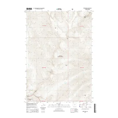
2015 Map of Sheep Mesa
USGS Topo · Published 2015About this map
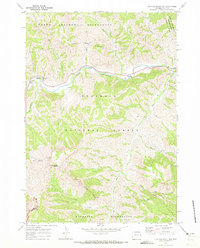
Sheep Mesa and the surrounding heights of the Absaroka Range dominate this high-elevation landscape within the Shoshone National Forest. The map documents a wilderness shaped by geological and glacial forces, notably featuring the Blackwater Natural Bridge and the Fishhawk Glacier near Overlook Mtn. The drainages of Blackwater Cr and Fishhawk Cr carve through deep valleys between prominent peaks like Coxcomb Mtn and Battlement Mtn. A small portion of the Teton National Forest is visible in the southwest corner near Glacier Basin. This 2015 record provides a precise look at the glaciated terrain and remote summits of Northwest Wyoming, including the significant topographic features of Wapiti Ridge and the Fortress Mtn formation.
Find a feature on this map
29 named features on this map. Tap any name to fly to it.
Don’t see what you’re looking for? This feature index may not catch every label — zoom into the map to look around manually.
Map Details
Editions of this 2015 Sheep Mesa Map
This is the sole edition of this map. No revisions or reprints were ever made.
Other maps of this area

1893 · Ishawooa
USGS Topo · 1:125,000

1895 · Ishawooa
USGS Topo · 1:125,000

1899 · Ishawooa
USGS Topo · 1:125,000

1955 · Cody
USGS Topo · 1:250,000

1958 · Cody
USGS Topo · 1:250,000

1962 · Cody
USGS Topo · 1:250,000
1970 · Sheep Mesa
USGS Topo · 1:24,000
1970 · Chimney Rock
USGS Topo · 1:24,000
1970 · Clouds Home Peak
USGS Topo · 1:24,000
1970 · Clayton Mountain
USGS Topo · 1:24,000