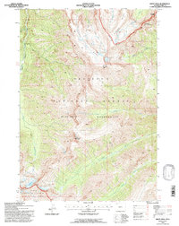
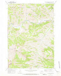
1991 Map of Sheep Mesa
USGS Topo · Published 1997About this map
Sheep Mesa dominates the high-altitude topography of this Park County region, where the Washakie Wilderness and Teton Wilderness converge. The landscape is defined by its dramatic geological formations, most notably the Blackwater Natural Bridge near the northeastern edge and the glacial activity visible at Fishhawk Glacier. Named peaks like Battlement Mountain, Fortress Mountain, and Coxcomb Mountain create a fortress-like perimeter around deep drainages such as Blackwater Creek and Seclusion Creek. This map, based on 1969 aerial photography with 1991 field revisions, provides a look at the undisturbed wilderness within the Shoshone National Forest. The presence of Glacier Basin and Overlook Mtn at the southern boundary highlights the extreme elevations and glacial features that have shaped the hydrography of the Barron Creek and Rampart Creek systems.
Find a feature on this map
22 named features on this map. Tap any name to fly to it.
Don’t see what you’re looking for? This feature index may not catch every label — zoom into the map to look around manually.
Map Details
Editions of this 1991 Sheep Mesa Map
This is the sole edition of this map. No revisions or reprints were ever made.
Other maps of this area

1893 · Ishawooa
USGS Topo · 1:125,000

1895 · Ishawooa
USGS Topo · 1:125,000

1899 · Ishawooa
USGS Topo · 1:125,000

1955 · Cody
USGS Topo · 1:250,000

1958 · Cody
USGS Topo · 1:250,000

1962 · Cody
USGS Topo · 1:250,000
1970 · Sheep Mesa
USGS Topo · 1:24,000
1970 · Chimney Rock
USGS Topo · 1:24,000
1970 · Clouds Home Peak
USGS Topo · 1:24,000
1970 · Clayton Mountain
USGS Topo · 1:24,000