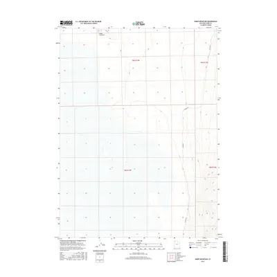
2017 Map of Sheep Mountain
USGS Topo · Published 2017About this map
Sheep Mountain dominates the northwestern terrain of this Box Elder County landscape, its elevation rising sharply above the surrounding salt flats and basins. This part of the Great Salt Lake Desert is defined by stark topographic transitions, where the steep contours of the mountain meet the expansive, low-lying wetlands and dry lake beds to the west and south. Historically, this is an area of profound isolation, marked by long stretches of unpaved travel ways such as W Hogup Rd and Flat Rd that skirt the edges of the high ground. The U.S. Department of the Interior survey reveals the grid of the Public Land Survey System, including t9n r13w and t8n r13w, which provide the essential spatial framework for researchers tracing historical land boundaries in this desolate corner of Utah.
Find a feature on this map
7 named features on this map. Tap any name to fly to it.
Don’t see what you’re looking for? This feature index may not catch every label — zoom into the map to look around manually.
Map Details
Editions of this 2017 Sheep Mountain Map
This is the sole edition of this map. No revisions or reprints were ever made.
Other maps of this area

1954 · Brigham City
USGS Topo · 1:250,000

1958 · Brigham City
USGS Topo · 1:250,000

1962 · Brigham City
USGS Topo · 1:250,000

1969 · Hogup Bar
USGS Topo · 1:24,000

1971 · Red Dome
USGS Topo · 1:24,000

1971 · Matlin
USGS Topo · 1:24,000

1983 · Lemay
USGS Topo · 1:24,000

1983 · Terrace Mountain East
USGS Topo · 1:24,000

1983 · Sheep Mountain
USGS Topo · 1:24,000

1983 · Groome
USGS Topo · 1:24,000