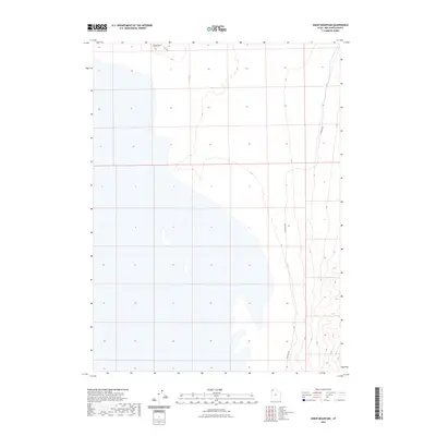
2023 Map of Sheep Mountain
USGS Topo · Published 2023About this map
Sheep Mtn rises in the northwestern corner of this territory, marking a high point in a largely open and remote expanse of Box Elder County. The landscape is defined by its isolation, with only minimal infrastructure present to navigate the terrain. Two primary travel routes provide access to the area: Flat Rd, which skirts the northern foothills, and W Hogup Rd, which runs north-to-south along the eastern edge of the quadrangle. These roads suggest a landscape primarily used for transit or range management rather than permanent settlement. Large sections of the map depict intermittent water or wetlands, illustrating the seasonal nature of the local hydrology and the shifting environment typical of this part of Utah.
Find a feature on this map
3 named features on this map. Tap any name to fly to it.
Don’t see what you’re looking for? This feature index may not catch every label — zoom into the map to look around manually.
Map Details
Editions of this 2023 Sheep Mountain Map
This is the sole edition of this map. No revisions or reprints were ever made.
Other maps of this area

1954 · Brigham City
USGS Topo · 1:250,000

1958 · Brigham City
USGS Topo · 1:250,000

1962 · Brigham City
USGS Topo · 1:250,000

1969 · Hogup Bar
USGS Topo · 1:24,000

1971 · Red Dome
USGS Topo · 1:24,000

1971 · Matlin
USGS Topo · 1:24,000

1983 · Lemay
USGS Topo · 1:24,000

1983 · Terrace Mountain East
USGS Topo · 1:24,000

1983 · Sheep Mountain
USGS Topo · 1:24,000

1983 · Groome
USGS Topo · 1:24,000