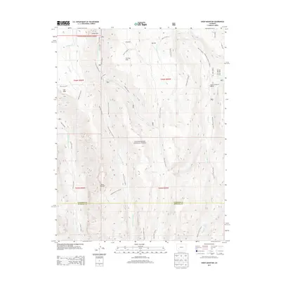
2013 Map of Sheep Mountain
USGS Topo · Published 2013About this map
Uncompahgre National Forest encompasses this high-altitude landscape along the border of Gunnison and Hinsdale counties. The terrain is defined by a dense network of drainages including the Little Cimarron River, Big Blue Cr, and Fall Cr. This 2013 survey illustrates a wilderness primarily accessed by foot and pack trails, such as the Big Blue Creek Trl 9232.0 and the Little Cimarron Trl 6229.0. Distinctive high-country features like Sheep Mountain and High Mesa rise above timberline, while flatter openings like Johnson Park, Fire Park, and Big Park suggest natural clearings in the forest. Human infrastructure is limited to backcountry sites like the Big Blue Campground, emphasizing the area's role as a protected natural corridor. The presence of Slide Lake and various ephemeral draws reflects the complex hydrology of this part of the Western Slope.
Find a feature on this map
31 named features on this map. Tap any name to fly to it.
Don’t see what you’re looking for? This feature index may not catch every label — zoom into the map to look around manually.
Map Details
Editions of this 2013 Sheep Mountain Map
This is the sole edition of this map. No revisions or reprints were ever made.
Other maps of this area

1902 · Ouray
USGS Topo · 1:62,500

1903 · Lake City
USGS Topo · 1:62,500

1904 · Ouray
USGS Topo · 1:62,500

1905 · Lake City
USGS Topo · 1:62,500

1908 · Uncompahgre
USGS Topo · 1:125,000

1909 · Montrose
USGS Topo · 1:125,000

1911 · Uncompahgre
USGS Topo · 1:125,000

1911 · Montrose
USGS Topo · 1:125,000

1956 · Montrose
USGS Topo · 1:250,000

1959 · Montrose
USGS Topo · 1:250,000