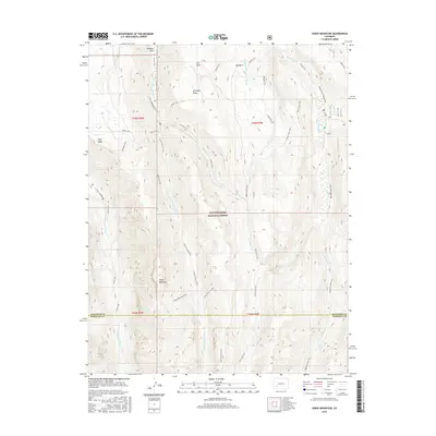
2016 Map of Sheep Mountain
USGS Topo · Published 2016About this map
Uncompahgre National Forest dominates this high-elevation landscape, where the headwaters of the Little Cimarron River and Big Blue Cr carve deep drainages through the alpine terrain. Located along the boundary of Gunnison and Hinsdale counties, the area is defined by massive landforms like Sheep Mountain and High Mesa. A complex network of pack trails, including the Alpine Trail and Fall Creek Trail, suggests a long history of seasonal land use for grazing and forest management in remote basins like Johnson Park, Fire Park, and Big Park. The presence of the Alpine Guard Station Trail points to early administrative outposts used by the U.S. Forest Service to oversee this high country. Hydrological features such as Slide Lake and the E Fork Little Cimarron River highlight the watershed's importance to the surrounding region during the early 21st century.
Find a feature on this map
31 named features on this map. Tap any name to fly to it.
Don’t see what you’re looking for? This feature index may not catch every label — zoom into the map to look around manually.
Map Details
Editions of this 2016 Sheep Mountain Map
This is the sole edition of this map. No revisions or reprints were ever made.
Other maps of this area

1902 · Ouray
USGS Topo · 1:62,500

1903 · Lake City
USGS Topo · 1:62,500

1904 · Ouray
USGS Topo · 1:62,500

1905 · Lake City
USGS Topo · 1:62,500

1908 · Uncompahgre
USGS Topo · 1:125,000

1909 · Montrose
USGS Topo · 1:125,000

1911 · Uncompahgre
USGS Topo · 1:125,000

1911 · Montrose
USGS Topo · 1:125,000

1956 · Montrose
USGS Topo · 1:250,000

1959 · Montrose
USGS Topo · 1:250,000