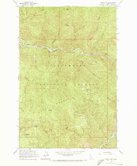
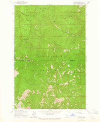
1963 Map of Sheep Mtn
USGS Topo · Published 1973About this map
The North Fork Clearwater River winds through the heart of the Clearwater National Forest in this early 1960s survey. The landscape is defined by the sharp relief of the Clearwater Mountains, where high-elevation landmarks like Sheep Mountain and Eagle Point Lookout Tower served as critical observation posts for forest management. This era reflects the peak of federal administrative presence in the backcountry, evidenced by the Canyon Ranger Station and nearby Heliport and Radio Facility. Recreational access is concentrated along the river corridor at the Aquarius Campground, while the surrounding terrain is accessed by a singular Jeep Trail. For the historian, the map preserves the exact locations of fire lookouts and drainage names like Grasshopper Creek and Sourdough Creek before modern forest road expansions altered the primitive character of the Idaho wilderness.
Find a feature on this map
43 named features on this map. Tap any name to fly to it.
Don’t see what you’re looking for? This feature index may not catch every label — zoom into the map to look around manually.
Map Details
Editions of this 1963 Sheep Mtn Map
3 editions found
Other maps of this area

1911 · Lolo
USGS Topo · 1:250,000

1913 · Lolo
USGS Topo · 1:250,000

1923 · Washington Creek
USGS Topo · 1:125,000

1956 · Hamilton
USGS Topo · 1:250,000

1959 · Hamilton
USGS Topo · 1:250,000

1960 · Hamilton
USGS Topo · 1:250,000
1963 · Mallard Peak
USGS Topo · 1:24,000

1963 · Sheep Mtn
USGS Topo · 1:24,000
1963 · Buzzard Roost
USGS Topo · 1:24,000
1963 · Pole Mtn
USGS Topo · 1:24,000