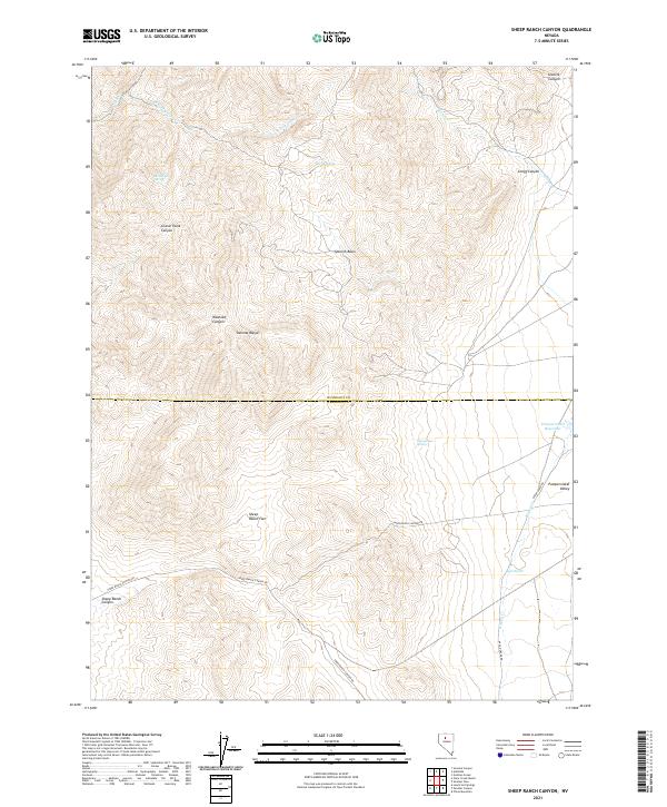
2021 Map of Sheep Ranch Canyon
USGS Topo · Published 2021About this map
Sonoma Range peaks dominate this high-desert landscape along the boundary of Humboldt and Pershing counties. The terrain is defined by its deep drainages and crucial water sources, which dictated movement and land use in this arid region of Nevada. Significant canyons like Washoke Canyon and Grand Trunk Canyon cut through the mountains, leading down toward the broader Pumpernickel Valley to the east.
Find a feature on this map
24 named features on this map. Tap any name to fly to it.
Don’t see what you’re looking for? This feature index may not catch every label — zoom into the map to look around manually.
Map Details
Editions of this 2021 Sheep Ranch Canyon Map
This is the sole edition of this map. No revisions or reprints were ever made.
Other maps of this area

1932 · Sonoma Range
USGS Topo · 1:250,000

1939 · Sonoma Range
USGS Topo · 1:250,000

1955 · Winnemucca
USGS Topo · 1:250,000

1958 · Winnemucca
USGS Topo · 1:250,000

1958 · Winnemucca
USGS Topo · 1:62,500

1961 · Leach Hot Springs
USGS Topo · 1:62,500

1962 · Winnemucca
USGS Topo · 1:250,000

1965 · Goldrun Creek
USGS Topo · 1:24,000

1965 · Edna Mountain
USGS Topo · 1:62,500
1965 · Smelser Pass
USGS Topo · 1:24,000