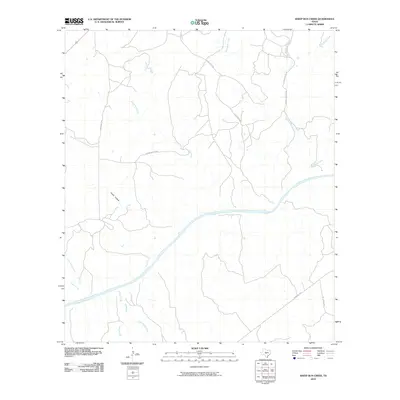
2010 Map of Sheep Run Creek
USGS Topo · Published 2010About this map
The Llano River winds through this central Texas landscape, serving as the primary drainage for a network of seasonal and perennial streams. The terrain is defined by its drainage patterns, where tributaries like Sheep Run Creek, Leon Creek, and Rocky Creek carve deep into the plateau. Named topographic depressions such as Cedar Hollow and Chimney Hollow suggest the limestone-influenced geology typical of the region.
Find a feature on this map
18 named features on this map. Tap any name to fly to it.
Don’t see what you’re looking for? This feature index may not catch every label — zoom into the map to look around manually.
Map Details
Editions of this 2010 Sheep Run Creek Map
This is the sole edition of this map. No revisions or reprints were ever made.
Other maps of this area

1887 · Mason
USGS Topo · 1:125,000

1894 · Mason
USGS Topo · 1:125,000

1954 · Llano
USGS Topo · 1:250,000

1955 · Llano
USGS Topo · 1:250,000

1956 · Llano
USGS Topo · 1:250,000
1967 · Monument Mountain SE
USGS Topo · 1:24,000

1968 · Monument Mountain
USGS Topo · 1:24,000
1968 · Turtle Creek
USGS Topo · 1:24,000

1968 · Sheep Run Creek
USGS Topo · 1:24,000

1968 · London
USGS Topo · 1:24,000