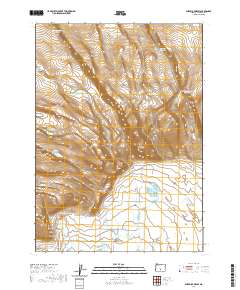
2020 Map of Sheeplick Draw
USGS Topo · Published 2020About this map
Sheeplick Draw carves through the high desert landscape of Lake County, revealing a sophisticated network of water management in a demanding environment. This 2020 survey documents numerous small-scale reservoirs such as Guinea Reservoir Number 1, Big Reservoir, and O'Leary Reservoir Number 1, which speak to the essential ranching and irrigation needs of the region. Notable terrain features like Flatiron Point, Squaw Butte, and Klippel Point define the local topography. Further south, the presence of Johnson Creek Spring and Deadhorse Spring indicate the critical role of reliable water sources. The area is intersected by local routes including Shuffield Rd and Co Hwy 4-16A, providing access to the more isolated basins like Sheeplick Lake and Juniper Lake.
Find a feature on this map
36 named features on this map. Tap any name to fly to it.
Don’t see what you’re looking for? This feature index may not catch every label — zoom into the map to look around manually.
Map Details
Editions of this 2020 Sheeplick Draw Map
This is the sole edition of this map. No revisions or reprints were ever made.
Other maps of this area

1955 · Crescent
USGS Topo · 1:250,000

1955 · Klamath Falls
USGS Topo · 1:250,000

1957 · Crescent
USGS Topo · 1:250,000

1958 · Crescent
USGS Topo · 1:250,000

1958 · Klamath Falls
USGS Topo · 1:250,000

1966 · Summer Lake
USGS Topo · 1:24,000

1970 · Crescent
USGS Topo · 1:250,000

1974 · Lake Abert
USGS Topo · 1:100,000

1981 · Thorn Lake
USGS Topo · 1:24,000
1982 · Egli Rim
USGS Topo · 1:24,000