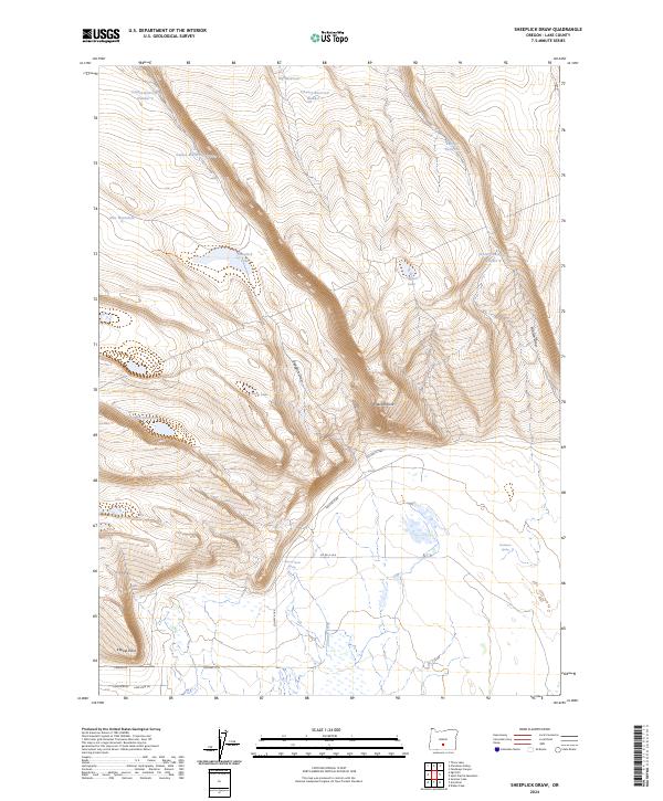
2024 Map of Sheeplick Draw
USGS Topo · Published 2024About this map
Sheeplick Draw characterizes this stretch of the Oregon high desert, where a complex network of ephemeral water management systems defines the landscape. The reliance on seasonal water is evident through numerous catchments such as Guinee Reservoir Number 2, O'Leary Reservoir Number 1, and the Pattern Reservoir. These features, alongside New Waterhole and various springs, underscore the importance of water security for ranching and land use in this arid region. The terrain is marked by significant elevations like Flatiron Point and Klippel Point, which overlook natural depressions and drainage systems including Watson Draw and Sheeplick Lake. The sparse infrastructure is limited to rural routes such as Shuffield Rd and Co Hwy 4-16A, which provide access through the vast public land survey sections.
Find a feature on this map
31 named features on this map. Tap any name to fly to it.
Don’t see what you’re looking for? This feature index may not catch every label — zoom into the map to look around manually.
Map Details
Editions of this 2024 Sheeplick Draw Map
This is the sole edition of this map. No revisions or reprints were ever made.
Other maps of this area

1955 · Crescent
USGS Topo · 1:250,000

1955 · Klamath Falls
USGS Topo · 1:250,000

1957 · Crescent
USGS Topo · 1:250,000

1958 · Crescent
USGS Topo · 1:250,000

1958 · Klamath Falls
USGS Topo · 1:250,000

1966 · Summer Lake
USGS Topo · 1:24,000

1970 · Crescent
USGS Topo · 1:250,000

1974 · Lake Abert
USGS Topo · 1:100,000

1981 · Thorn Lake
USGS Topo · 1:24,000
1982 · Egli Rim
USGS Topo · 1:24,000