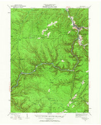
1935 Map of Sheffield
USGS Topo · Published 1958About this map
Sheffield stands as the primary industrial and commercial hub of this landscape, situated at the confluence of several major drainages. The Sheffield & Tionesta and Baltimore and Ohio railroads anchor the local economy, connecting timber and resource extraction points along Tionesta Creek and Minister Creek. The presence of multiple CCC Camps during this 1930s survey highlights the era of massive reforestation and conservation efforts within the State Game Preserve.
Find a feature on this map
103 named features on this map. Tap any name to fly to it.
Don’t see what you’re looking for? This feature index may not catch every label — zoom into the map to look around manually.
Map Details
Editions of this 1935 Sheffield Map
2 editions found

Other maps of this area

1906 · Warren
USGS Topo · 1:62,500

1907 · Warren
USGS Topo · 1:62,500

1908 · Warren
USGS Topo · 1:62,500

1918 · Loleta
USGS Topo · 1:62,500

1922 · Tionesta
USGS Topo · 1:62,500

1924 · Tionesta
USGS Topo · 1:62,500

1926 · Youngsville
USGS Topo · 1:62,500

1927 · Tidioute
USGS Topo · 1:48,000

1929 · Youngsville
USGS Topo · 1:62,500

1930 · Tidioute
USGS Topo · 1:62,500
Featured Places
- Sheffield Township, PA
- Cherry Grove Township, PA
- Watson Township, PA
- Balltown, Howe Township
- Hermit Spring, PA