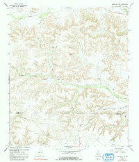
1967 Map of Sheffield NW
USGS Topo · Published 1992About this map
Isolated cattle operations and emerging energy infrastructure define this mid-century Trans-Pecos landscape. Spanning the Pecos and Terrell County line, the terrain is dominated by complex drainage systems such as Sheffield Draw and Lower Fourmile Draw. Local habitation centers on family-named holdings like Cannon Ranch, Clark Brothers Ranch, and Slaughter Ranch. The presence of several Gas Wells and an extensive Pipeline indicate the region's industrial shift toward natural gas extraction by the late 1960s. High points such as Blackstone and Slaughter overlook deep incisions like Bearfoot Canyon, while vital water sources for livestock are marked by the Perkins Windmill and various water tanks. Numerous drill holes scattered across the topography suggest a period of active mineral exploration and geological assessment during this era.
Find a feature on this map
18 named features on this map. Tap any name to fly to it.
Don’t see what you’re looking for? This feature index may not catch every label — zoom into the map to look around manually.
Map Details
Editions of this 1967 Sheffield NW Map
2 editions found
Other maps of this area

1929 · Sheffield
USGS Topo · 1:125,000

1929 · Independence Draw Quadrangle
USGS Topo · 1:125,000

1954 · Fort Stockton
USGS Topo · 1:250,000

1954 · Sonora
USGS Topo · 1:250,000

1958 · Sonora
USGS Topo · 1:250,000

1958 · Fort Stockton
USGS Topo · 1:250,000

1967 · Divide Country
USGS Topo · 1:24,000

1967 · Sheffield NW
USGS Topo · 1:24,000

1967 · Horsehead Canyon
USGS Topo · 1:24,000

1967 · Deer Canyon
USGS Topo · 1:24,000