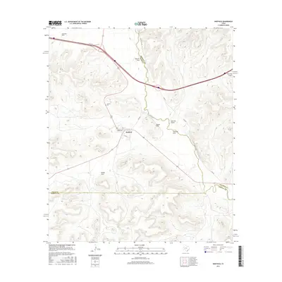
2016 Map of Sheffield
USGS Topo · Published 2016About this map
Sheffield occupies a critical junction in the Trans-Pecos region, situated where the arid draws of the Edwards Plateau meet the winding Pecos River. The settlement is defined by a sparse grid of streets including Pine St and Garrett St, serving as a remote outpost at the intersection of Pecos, Crockett, and Terrell counties. The landscape is dominated by steep-walled drainage systems and prominent landmarks like Squaw Peak, which overlooks the river valley. Water remains the primary shaper of the terrain here, evident in the convergence of Fourmile Draw, Twomile Draw, and Sheffield Draw toward the river. For genealogists and local historians, the Sheffield Cem and the location of Pecos Spring provide fixed points of reference for the community's development in this harsh, canyon-carved corner of West Texas.
Find a feature on this map
21 named features on this map. Tap any name to fly to it.
Don’t see what you’re looking for? This feature index may not catch every label — zoom into the map to look around manually.
Map Details
Editions of this 2016 Sheffield Map
This is the sole edition of this map. No revisions or reprints were ever made.
Other maps of this area

1929 · Sheffield
USGS Topo · 1:125,000

1954 · Sonora
USGS Topo · 1:250,000

1958 · Sonora
USGS Topo · 1:250,000

1967 · Divide Country
USGS Topo · 1:24,000

1967 · Sheffield NW
USGS Topo · 1:24,000

1967 · Horsehead Canyon
USGS Topo · 1:24,000

1967 · Deer Canyon
USGS Topo · 1:24,000

1967 · Fort Lancaster
USGS Topo · 1:24,000

1967 · Sheffield SE
USGS Topo · 1:24,000

1967 · Dead Man Canyon
USGS Topo · 1:24,000