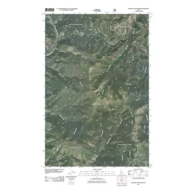
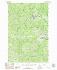
2011 Map of Shefoot Mountain
USGS Topo · Published 2011About this map
The Old North Star Mine sits high in the Shoshone County backcountry, a reminder of the prospecting history that shaped this corner of northern Idaho. In this part of the Bitterroot mountains, small settlements like Pearson, Bogle, and Falcon are situated along the winding paths of the North Fork Saint Joe River and Loop Creek. The landscape is dominated by a series of prominent summits and ridges, including Shefoot Mountain, Triangle Peak, and Nelson Peak, which define the drainage basins for numerous local waterways. The map details an intricate network of creeks, such as Telichpah Creek, Skookum Creek, and Long Liz Creek, that flow through the steep terrain between named landmarks like Tanglefoot Point and Kelly Pinnacle. This survey illustrates the relationship between the remote rail-and-river corridor and the formidable mountain peaks that hem in the narrow valleys.
Find a feature on this map
39 named features on this map. Tap any name to fly to it.
Don’t see what you’re looking for? This feature index may not catch every label — zoom into the map to look around manually.
Map Details
Editions of this 2011 Shefoot Mountain Map
This is the sole edition of this map. No revisions or reprints were ever made.
Other maps of this area

1914 · Avery
USGS Topo · 1:125,000

1917 · Avery
USGS Topo · 1:125,000

1956 · Saltese
USGS Topo · 1:62,500

1956 · Wallace
USGS Topo · 1:250,000

1957 · Wallace
USGS Topo · 1:62,500

1960 · Wallace
USGS Topo · 1:250,000
1969 · Thor Mountain
USGS Topo · 1:24,000
1969 · Three Sisters
USGS Topo · 1:24,000
1969 · Fishhook Creek
USGS Topo · 1:24,000
1988 · Mullan
USGS Topo · 1:24,000