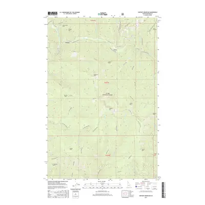
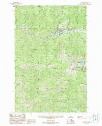
2017 Map of Shefoot Mountain
USGS Topo · Published 2017About this map
The St. Joe National Forest dominates this mountain landscape, characterized by the historical legacy of the transcontinental rail industry and early 20th-century transportation routes. The prominent Hiawatha Rail Trail follows the path of the Old Milwaukee Road RR Grade, winding through steep terrain near the settlements of Pearson and Falcon. This area of Shoshone County is defined by high ridgelines and named peaks including Shefoot Mtn and Nelson Peak, while drainages like Lucky Swede Gulch and Coddington Gulch hint at the region's prospecting and mining heritage. The map details a complex network of recreational and historic paths, such as the Nelson Ridge NRT and Telchpah Creek NRT, which provide access to remote landmarks like Tanglefoot Point and Big Dick Point.
Find a feature on this map
64 named features on this map. Tap any name to fly to it.
Don’t see what you’re looking for? This feature index may not catch every label — zoom into the map to look around manually.
Map Details
Editions of this 2017 Shefoot Mountain Map
This is the sole edition of this map. No revisions or reprints were ever made.
Other maps of this area

1914 · Avery
USGS Topo · 1:125,000

1917 · Avery
USGS Topo · 1:125,000

1956 · Saltese
USGS Topo · 1:62,500

1956 · Wallace
USGS Topo · 1:250,000

1957 · Wallace
USGS Topo · 1:62,500

1960 · Wallace
USGS Topo · 1:250,000
1969 · Thor Mountain
USGS Topo · 1:24,000
1969 · Three Sisters
USGS Topo · 1:24,000
1969 · Fishhook Creek
USGS Topo · 1:24,000
1988 · Mullan
USGS Topo · 1:24,000