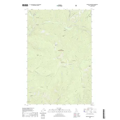
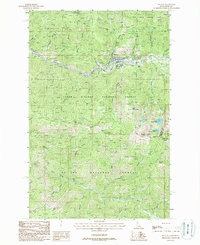
2020 Map of Shefoot Mountain
USGS Topo · Published 2020About this map
St. Joe National Forest encompasses this high-altitude terrain in Shoshone County, where the legacy of transcontinental railroading remains etched into the mountainsides. The Hiawatha Rail Trail and the Old Milwaukee Road RR Grade serve as prominent markers of industrial history, tracing a path through former railroad outposts like Pearson and Falcon. These routes navigate a landscape defined by significant peaks and drainages, including Shefoot Mtn, Nelson Peak, and the waters of the North Fork Saint Joe River.
Find a feature on this map
64 named features on this map. Tap any name to fly to it.
Don’t see what you’re looking for? This feature index may not catch every label — zoom into the map to look around manually.
Map Details
Editions of this 2020 Shefoot Mountain Map
This is the sole edition of this map. No revisions or reprints were ever made.
Other maps of this area

1914 · Avery
USGS Topo · 1:125,000

1917 · Avery
USGS Topo · 1:125,000

1956 · Saltese
USGS Topo · 1:62,500

1956 · Wallace
USGS Topo · 1:250,000

1957 · Wallace
USGS Topo · 1:62,500

1960 · Wallace
USGS Topo · 1:250,000
1969 · Thor Mountain
USGS Topo · 1:24,000
1969 · Three Sisters
USGS Topo · 1:24,000
1969 · Fishhook Creek
USGS Topo · 1:24,000
1988 · Mullan
USGS Topo · 1:24,000