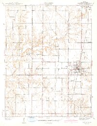
1942 Map of Shelburn
USGS Topo · Published 1942About this map
Coal extraction and rural agriculture define the landscape of central Sullivan County in the late 1930s. The bustling rail hub of Shelburn serves as a focal point, where the Chicago And Eastern Illinois railroad connects smaller settlements like Curryville and Standard. This 1942 edition captures the transition from small-scale farming to industrial operations, notably marked by the presence of the Linda Lou Mine south of the main town site.
Find a feature on this map
28 named features on this map. Tap any name to fly to it.
Don’t see what you’re looking for? This feature index may not catch every label — zoom into the map to look around manually.
Map Details
Editions of this 1942 Shelburn Map
2 editions found
Other maps of this area

1932 · Marshall
USGS Topo · 1:62,500

1937 · Marshall
USGS Topo · 1:62,500

1940 · Lewis
USGS Topo · 1:24,000

1940 · Pimento
USGS Topo · 1:24,000

1942 · Fairbanks
USGS Topo · 1:24,000

1942 · Shelburn
USGS Topo · 1:24,000

1942 · Hutton
USGS Topo · 1:24,000

1943 · Merom
USGS Topo · 1:24,000

1943 · Hymera
USGS Topo · 1:24,000

1943 · Sullivan
USGS Topo · 1:24,000