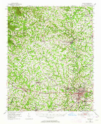
1950 Map of Shelby
USGS Topo · Published 1964About this map
Shelby serves as the focal point of this mid-century Cleveland County survey, situated at the junction of the Seaboard Air Line and the Southern R R. The textile industry’s footprint is evident through the presence of Ora Mill and Dover Mill, while the First Broad River and Second Broad River provide the primary drainage for a landscape dotted with rural centers like Lawndale and Boiling Springs.
Find a feature on this map
120 named features on this map. Tap any name to fly to it.
Don’t see what you’re looking for? This feature index may not catch every label — zoom into the map to look around manually.
Map Details
Editions of this 1950 Shelby Map
2 editions found
Other maps of this area

1895 · Hickory
USGS Topo · 1:125,000

1905 · Morganton
USGS Topo · 1:125,000

1906 · Kings Mountain
USGS Topo · 1:62,500

1908 · Kings Mountain
USGS Topo · 1:62,500

1909 · Gaffney
USGS Topo · 1:62,500

1909 · Lincolnton
USGS Topo · 1:62,500

1911 · Lincolnton
USGS Topo · 1:62,500

1950 · Shelby
USGS Topo · 1:62,500

1953 · Charlotte
USGS Topo · 1:250,000

1954 · Charlotte
USGS Topo · 1:250,000