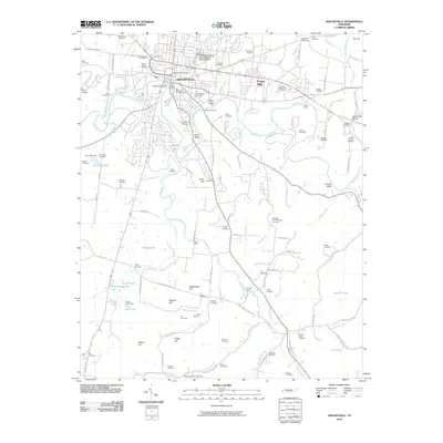
2010 Map of Shelbyville
USGS Topo · Published 2010About this map
The Duck River meanders across this part of central Tennessee, defining the urban and rural development of Shelbyville. This 2010 survey shows the city's growth around its core, including the Shelbyville Post Office and the sprawling Tennessee Walking Horse National Showgrounds. The river’s influence is visible in the numerous crossings that have served the community for generations, from the Shelbyville Dam to traditional river access points like Skull Camp Ford, Moore Ford, and Kizer Ford.
Find a feature on this map
127 named features on this map. Tap any name to fly to it.
Don’t see what you’re looking for? This feature index may not catch every label — zoom into the map to look around manually.
Map Details
Editions of this 2010 Shelbyville Map
This is the sole edition of this map. No revisions or reprints were ever made.
Other maps of this area

1936 · Booneville
USGS Topo · 1:24,000

1936 · Shelbyville
USGS Topo · 1:24,000

1936 · Deason
USGS Topo · 1:24,000

1936 · Cumberland Springs
USGS Topo · 1:24,000

1936 · Belleville
USGS Topo · 1:24,000

1936 · Wartrace
USGS Topo · 1:24,000

1936 · Unionville
USGS Topo · 1:24,000

1936 · Bedford
USGS Topo · 1:24,000

1936 · Normandy
USGS Topo · 1:24,000

1941 · Cumberland Springs
USGS Topo · 1:24,000