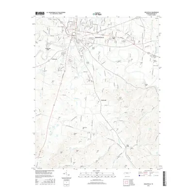
2016 Map of Shelbyville
USGS Topo · Published 2016About this map
Shelbyville serves as the central hub of this Bedford County landscape, where the Duck River winds past Coney Island and Green Island before reaching Shelbyville Mills. The map details a dense network of local cemeteries that offer significant value for genealogical research, including the Old Shelbyville City Cem, Willowmount Cem, and Mount Ararat Cem. The surrounding countryside is defined by small settlements like Himesville, Creekwood, and Flat Creek, each connected by a web of rural roads such as S Cannon Blvd and Warner Bridge Rd. Terrain features like Woods Bluff and Sugarcamp Hill rise above the many creek branches, while specialized landmarks such as Mullins Mill Bridge and the Hastings Camp Ground Cem indicate long-standing community centers and early industrial sites. The distribution of family-named plots like Stokes Cem, Arnold Cem, and Norman Cem reveals the deep-rooted settlement patterns of the mid-Tennessee region.
Find a feature on this map
221 named features on this map. Tap any name to fly to it.
Don’t see what you’re looking for? This feature index may not catch every label — zoom into the map to look around manually.
Map Details
Editions of this 2016 Shelbyville Map
This is the sole edition of this map. No revisions or reprints were ever made.
Other maps of this area

1936 · Booneville
USGS Topo · 1:24,000

1936 · Shelbyville
USGS Topo · 1:24,000

1936 · Deason
USGS Topo · 1:24,000

1936 · Cumberland Springs
USGS Topo · 1:24,000

1936 · Belleville
USGS Topo · 1:24,000

1936 · Wartrace
USGS Topo · 1:24,000

1936 · Unionville
USGS Topo · 1:24,000

1936 · Bedford
USGS Topo · 1:24,000

1936 · Normandy
USGS Topo · 1:24,000

1941 · Cumberland Springs
USGS Topo · 1:24,000