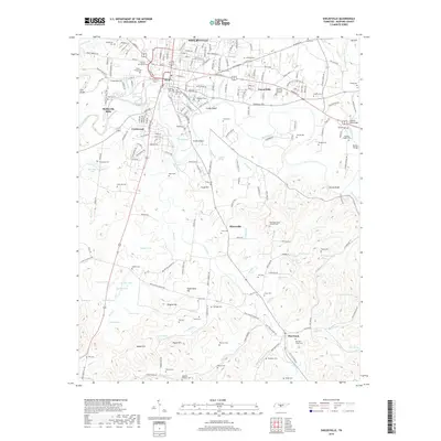
2019 Map of Shelbyville
USGS Topo · Published 2019About this map
The Duck River meanders through the heart of Bedford County, anchoring the regional hub of Shelbyville. This 2019 survey documents a landscape where modern development meets established family legacies, evidenced by the high concentration of small cemeteries scattered across the terrain. From the large Willow Mount Cem and Mount Ararat Cem in the city center to more remote burial sites like Old Flat Creek Cem and Hastings Camp Ground Cem, the map serves as a vital record for genealogists and local historians. The industrial footprint is marked by Shelbyville Mills and the CSX Transportation corridor, while the southern reaches transition into more agricultural pockets near Himesville and Flat Creek. Distinctive landforms such as Woods Bluff and Sugarcamp Hill rise above the numerous creek branches that feed the river system.
Find a feature on this map
231 named features on this map. Tap any name to fly to it.
Don’t see what you’re looking for? This feature index may not catch every label — zoom into the map to look around manually.
Map Details
Editions of this 2019 Shelbyville Map
This is the sole edition of this map. No revisions or reprints were ever made.
Other maps of this area

1936 · Booneville
USGS Topo · 1:24,000

1936 · Shelbyville
USGS Topo · 1:24,000

1936 · Deason
USGS Topo · 1:24,000

1936 · Cumberland Springs
USGS Topo · 1:24,000

1936 · Belleville
USGS Topo · 1:24,000

1936 · Wartrace
USGS Topo · 1:24,000

1936 · Unionville
USGS Topo · 1:24,000

1936 · Bedford
USGS Topo · 1:24,000

1936 · Normandy
USGS Topo · 1:24,000

1941 · Cumberland Springs
USGS Topo · 1:24,000