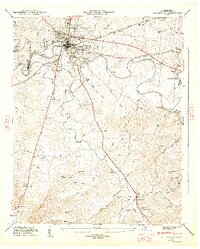
1947 Map of Shelbyville
USGS Topo · Published 1948About this map
The Duck River winds through the heart of Bedford County, defining the landscape around the regional hub of Shelbyville. In the late 1940s, the river served as a vital industrial artery, supporting Shelbyville Mills and a series of river-dependent landmarks like Sims Bridge and Shofner Bridge. The topography is marked by distinctive elevations such as Troup Hill and Wiggins Hill, with the river creating unique landforms like Coney Island and Green Island as it loops through the valley.
Find a feature on this map
66 named features on this map. Tap any name to fly to it.
Don’t see what you’re looking for? This feature index may not catch every label — zoom into the map to look around manually.
Map Details
Editions of this 1947 Shelbyville Map
2 editions found
Other maps of this area

1936 · Booneville
USGS Topo · 1:24,000

1936 · Shelbyville
USGS Topo · 1:24,000

1936 · Deason
USGS Topo · 1:24,000

1936 · Cumberland Springs
USGS Topo · 1:24,000

1936 · Belleville
USGS Topo · 1:24,000

1936 · Wartrace
USGS Topo · 1:24,000

1936 · Unionville
USGS Topo · 1:24,000

1936 · Bedford
USGS Topo · 1:24,000

1936 · Normandy
USGS Topo · 1:24,000

1941 · Cumberland Springs
USGS Topo · 1:24,000