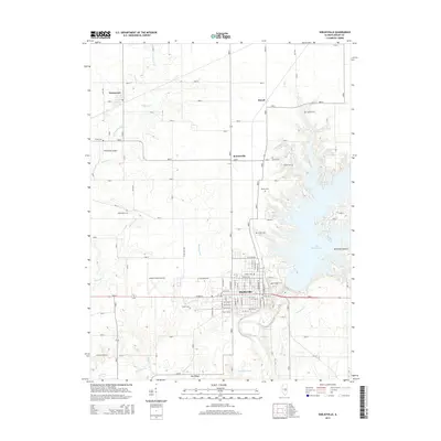
2015 Map of Shelbyville
USGS Topo · Published 2015About this map
Shelbyville serves as the central hub of this Central Illinois landscape, where the town grid meets the western shores of Lake Shelbyville. The map illustrates a transition from the structured residential blocks of the county seat to the sprawling water body and the winding course of the Kaskaskia River to the south. Historically significant burial sites are scattered throughout the rural hinterlands, including Bethel Cem, Smith Cem, and Moyer Cem near the lake’s edge, as well as Westervelt to the northwest. Smaller settlements like Rennerville and Duvall punctuate the agricultural landscape, which is defined by a dense network of township roads and drainage systems like Robinson Cr and Opossum Cr. The presence of both Shelby County Airport and Williamson Airport indicates the regional importance of general aviation in this part of Shelby County.
Find a feature on this map
109 named features on this map. Tap any name to fly to it.
Don’t see what you’re looking for? This feature index may not catch every label — zoom into the map to look around manually.
Map Details
Editions of this 2015 Shelbyville Map
This is the sole edition of this map. No revisions or reprints were ever made.
Other maps of this area

1935 · Sullivan
USGS Topo · 1:48,000

1940 · Sullivan
USGS Topo · 1:62,500

1942 · Shelbyville
USGS Topo · 1:62,500

1946 · Shelbyville
USGS Topo · 1:62,500

1947 · Stewardson
USGS Topo · 1:62,500

1949 · Stewardson
USGS Topo · 1:62,500

1949 · Dalton City
USGS Topo · 1:62,500

1958 · Decatur
USGS Topo · 1:250,000

1961 · Decatur
USGS Topo · 1:250,000

1980 · Middlesworth
USGS Topo · 1:24,000