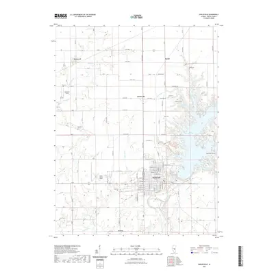
2021 Map of Shelbyville
USGS Topo · Published 2021About this map
Shelbyville serves as the central hub of this Central Illinois landscape, where the town's street grid meets the expansive waters of Lake Shelbyville. The map illustrates a developed shoreline characterized by numerous inlets like Lithia Springs Cove and Ninth Street Cove, while the surrounding countryside maintains its agricultural character with scattered settlements such as Westervelt and Rennerville. Local history and genealogy are anchored by a series of rural burying grounds, including Glenwood Cem, Bethel Cem, and Oliver Cem. Modern infrastructure like the Shelby County Airport and the General Dacey Trl highlight the area's role in regional transport and recreation, while the Kaskaskia River continues its course south of the city, winding through the timbered terrain of McGillian Hollow.
Find a feature on this map
99 named features on this map. Tap any name to fly to it.
Don’t see what you’re looking for? This feature index may not catch every label — zoom into the map to look around manually.
Map Details
Editions of this 2021 Shelbyville Map
This is the sole edition of this map. No revisions or reprints were ever made.
Other maps of this area

1935 · Sullivan
USGS Topo · 1:48,000

1940 · Sullivan
USGS Topo · 1:62,500

1942 · Shelbyville
USGS Topo · 1:62,500

1946 · Shelbyville
USGS Topo · 1:62,500

1947 · Stewardson
USGS Topo · 1:62,500

1949 · Stewardson
USGS Topo · 1:62,500

1949 · Dalton City
USGS Topo · 1:62,500

1958 · Decatur
USGS Topo · 1:250,000

1961 · Decatur
USGS Topo · 1:250,000

1980 · Middlesworth
USGS Topo · 1:24,000