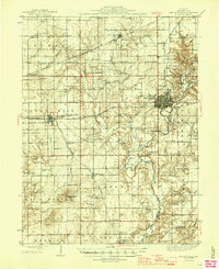
1946 Map of Shelbyville
USGS Topo · Published 1946About this map
The Kaskaskia River meanders south through the heart of this central Illinois landscape, passing the established county seat of Shelbyville. In the mid-1940s, this region was a dense network of agrarian communities and rural schoolhouses, including Killam School, Empire School, and Frogpond School. The geography is defined by a series of precisely named townships like Rose and Lakewood, where local infrastructure like the County Poor Farm and the Town House served the public.
Find a feature on this map
91 named features on this map. Tap any name to fly to it.
Don’t see what you’re looking for? This feature index may not catch every label — zoom into the map to look around manually.
Map Details
Editions of this 1946 Shelbyville Map
2 editions found
Other maps of this area

1935 · Sullivan
USGS Topo · 1:48,000

1940 · Sullivan
USGS Topo · 1:62,500

1941 · St. Elmo
USGS Topo · 1:62,500

1942 · Shelbyville
USGS Topo · 1:62,500

1944 · Ramsey
USGS Topo · 1:62,500

1945 · St. Elmo
USGS Topo · 1:62,500

1946 · Shelbyville
USGS Topo · 1:62,500

1946 · Ramsey
USGS Topo · 1:62,500

1947 · Pana
USGS Topo · 1:62,500

1947 · Stewardson
USGS Topo · 1:62,500