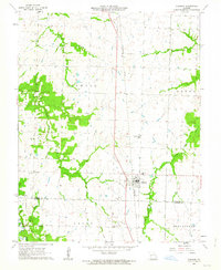
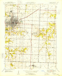
1962 Map of Sheldon
USGS Topo · Published 1963About this map
Sheldon serves as the primary hub on this Missouri prairie landscape, positioned along the Missouri Pacific railroad during the early 1960s. The region is characterized by a high density of rural institutions that offer significant value for genealogical research, including the Shanghi Ch and Avola Ch, alongside numerous family and community burial grounds such as Birkett Cem and Davis Cem. The boundary between Vernon and Barton Counties cuts across the southern portion of the map, where small schoolhouses like Oak Grove Sch and Prairie View Sch once anchored local farming districts. To the west, the terrain is defined by the winding course of Pleasant Run Creek and Landon Branch, illustrating the typical drainage patterns of the Drywood and Union townships before modern agricultural expansion significantly altered the field lines.
Find a feature on this map
24 named features on this map. Tap any name to fly to it.
Don’t see what you’re looking for? This feature index may not catch every label — zoom into the map to look around manually.
Map Details
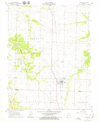
Editions of this 1962 Sheldon Map
2 editions found
Other maps of this area

1886 · Nevada
USGS Topo · 1:125,000

1894 · Nevada
USGS Topo · 1:125,000

1933 · Camp Clark
USGS Topo · 1:24,000

1939 · Dederick
USGS Topo · 1:24,000

1939 · Moundville
USGS Topo · 1:24,000
1942 · Dederick
USGS Topo · 1:24,000
1942 · Moundville
USGS Topo · 1:24,000

1947 · Joplin
USGS Topo · 1:250,000
1948 · Nevada
USGS Topo · 1:24,000

1949 · Joplin
USGS Topo · 1:250,000