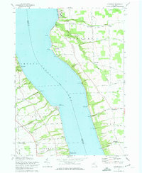
1971 Map of Sheldrake
USGS Topo · Published 1974About this map
The eastern and western shores of Cayuga Lake dominate this survey, capturing the mid-century landscape of the Finger Lakes region. Along the eastern bank, the historic village of Aurora is home to the Wells College campus and the industrial trace of the Lehigh Valley railroad, which runs south past King Ferry Station and Atwaters. The topography is defined by numerous dramatic ravines and waterfalls that cut through the lake's banks, such as Moonshine Falls and Clifton Falls along Paines Creek, and the deep incision of Beard Gully.
Find a feature on this map
73 named features on this map. Tap any name to fly to it.
Don’t see what you’re looking for? This feature index may not catch every label — zoom into the map to look around manually.
Map Details
Editions of this 1971 Sheldrake Map
2 editions found
Other maps of this area

1899 · Auburn
USGS Topo · 1:62,500

1902 · Geneva
USGS Topo · 1:62,500

1902 · Genoa
USGS Topo · 1:62,500

1902 · Ovid
USGS Topo · 1:62,500

1902 · Auburn
USGS Topo · 1:62,500

1942 · Ovid
USGS Topo · 1:31,680

1942 · Ludlowville
USGS Topo · 1:24,000

1942 · Lodi
USGS Topo · 1:24,000

1942 · Sheldrake
USGS Topo · 1:24,000

1942 · Genoa
USGS Topo · 1:24,000