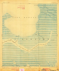
1893 Map of Shell Beach
USGS Topo · Published 1902About this map
St Bernard Parish's coastal wetlands and early rail connections are documented in this late nineteenth-century survey, conducted when the Shell Beach Railroad provided a direct link between the interior and the shores of Lake Borgne. The settlement of Shell Beach sits at the terminus of this rail line, while nearby Yscloskey and Florissant mark the path of development following the natural levees of the region's complex water systems.
Find a feature on this map
23 named features on this map. Tap any name to fly to it.
Don’t see what you’re looking for? This feature index may not catch every label — zoom into the map to look around manually.
Map Details
Editions of this 1893 Shell Beach Map
3 editions found
Other maps of this area

1891 · Pointe a La Hache
USGS Topo · 1:62,500

1892 · Chef Menteur
USGS Topo · 1:62,500

1892 · St. Bernard
USGS Topo · 1:62,500

1892 · Pointe a La Hache
USGS Topo · 1:62,500

1893 · Rigolets
USGS Topo · 1:62,500

1893 · La Fortuna
USGS Topo · 1:62,500

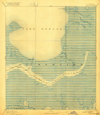
1893 · Shell Beach
USGS Topo · 1:62,500

1893 · Toulme
USGS Topo · 1:62,500

1893 · Dime
USGS Topo · 1:62,500

1895 · Bodreau
USGS Topo · 1:62,500