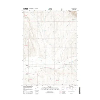
2015 Map of Shell
USGS Topo · Published 2015About this map
Shell serves as the focal point of this Big Horn County landscape, where the high desert terrain meets the eastern edge of the Bighorn National Forest. The map illustrates a complex network of water management essential to the region's ranching history, featuring the Shell Canal, High Line Ditch, and Whaley Ditch which divert water from Shell Creek. Genealogical interest is anchored by the Shell Cemetery and Whaley Cemetery, while the local transportation grid connects rural points like Flitners Corner and Reeves Corner. The rugged topography is defined by features such as Red Gulch and Douglas Draw, alongside water storage at Ewen Reservoir and Ewen Pence Gulch Reservoir. This 2015 update preserves the spatial relationship between historic irrigation routes and the modern road system, including Red Gulch Road and Trapper Creek Road.
Find a feature on this map
43 named features on this map. Tap any name to fly to it.
Don’t see what you’re looking for? This feature index may not catch every label — zoom into the map to look around manually.
Map Details
Editions of this 2015 Shell Map
This is the sole edition of this map. No revisions or reprints were ever made.
Other maps of this area

1898 · Bald Mountain
USGS Topo · 1:125,000

1901 · Bald Mountain
USGS Topo · 1:125,000

1955 · Sheridan
USGS Topo · 1:250,000

1958 · Sheridan
USGS Topo · 1:250,000

1960 · White Sulphur Spring
USGS Topo · 1:24,000

1960 · Black Mountain
USGS Topo · 1:24,000

1960 · Manderson NE
USGS Topo · 1:24,000

1960 · Hidden Tepee Creek
USGS Topo · 1:24,000

1960 · Devils Kitchen
USGS Topo · 1:24,000

1960 · Shell
USGS Topo · 1:24,000