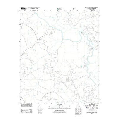
2011 Map of Shell Bluff Landing
USGS Topo · Published 2011About this map
The Savannah River dominates this landscape along the Georgia-South Carolina border, defining a corridor of riverfront landings and intricate waterways. This early 21st-century topographic study captures the traditional river access points that have long anchored local commerce and transport, including Shell Bluff Landing, Hancock Landing, and Flowery Gap Landing. The terrain is marked by a complex network of wetlands and oxbow formations like Bent Lake, Black Lake, and Red Lake, illustrating the river's historical migration through the floodplain.
Find a feature on this map
42 named features on this map. Tap any name to fly to it.
Don’t see what you’re looking for? This feature index may not catch every label — zoom into the map to look around manually.
Map Details
Editions of this 2011 Shell Bluff Landing Map
This is the sole edition of this map. No revisions or reprints were ever made.
Other maps of this area

1920 · Ellenton
USGS Topo · 1:48,000

1920 · Greens Cut
USGS Topo · 1:62,500

1920 · Talatha
USGS Topo · 1:48,000

1921 · Augusta
USGS Topo · 1:62,500

1921 · Talatha
USGS Topo · 1:62,500

1921 · Ellenton
USGS Topo · 1:62,500

1943 · Greens Cut
USGS Topo · 1:62,500

1943 · Augusta East
USGS Topo · 1:125,000

1943 · Talatha
USGS Topo · 1:62,500

1943 · Augusta
USGS Topo · 1:62,500