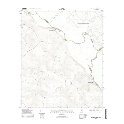
2014 Map of Shell Bluff Landing
USGS Topo · Published 2014About this map
Shell Bluff Landing serves as a prominent landmark along the winding Savannah River, where the boundary between Georgia and South Carolina is defined by the water's course. This riverfront landscape is characterized by the expansive Savannah River National Forest and a series of sharp river bends, including the notable Point Comfort and Flowers Point. The terrain is deeply carved by numerous tributaries such as Boggy Gut Cr, McBean Cr, and Newberry Cr, creating a complex network of ridges and drainages that shaped local settlement patterns.
Find a feature on this map
45 named features on this map. Tap any name to fly to it.
Don’t see what you’re looking for? This feature index may not catch every label — zoom into the map to look around manually.
Map Details
Editions of this 2014 Shell Bluff Landing Map
This is the sole edition of this map. No revisions or reprints were ever made.
Other maps of this area

1920 · Ellenton
USGS Topo · 1:48,000

1920 · Greens Cut
USGS Topo · 1:62,500

1920 · Talatha
USGS Topo · 1:48,000

1921 · Augusta
USGS Topo · 1:62,500

1921 · Talatha
USGS Topo · 1:62,500

1921 · Ellenton
USGS Topo · 1:62,500

1943 · Greens Cut
USGS Topo · 1:62,500

1943 · Augusta East
USGS Topo · 1:125,000

1943 · Talatha
USGS Topo · 1:62,500

1943 · Augusta
USGS Topo · 1:62,500