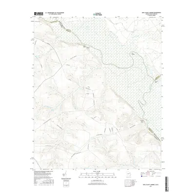
2017 Map of Shell Bluff Landing
USGS Topo · Published 2017About this map
Shell Bluff rises over the southern banks of the Savannah River, marking a prominent geological and historical landmark where Georgia meets South Carolina. This modern survey illustrates the intricate wetlands and oxbow formations that define the river's path, including D'Antignac Swamp, Black Lake, and Red Lake. The landscape is a complex network of tributaries such as Boggy Gut Cr, Newberry Cr, and Stewart Br, which drain the elevated ridges of Richmond and Burke counties. Human presence is concentrated along rural routes like Shell Bluff Landing Rd and Hancock Landing RD, leading to small riverfront sites like Shell Bluff Landing. The inclusion of the Rhodes Air Ranch Airport and family-named water bodies like Smiths Pond highlights the area's mix of private landholdings and aviation history. Further east across the state line, the confluence of Upper Three Runs and Fourmile Br with the main channel showcases the shifting hydrology of the Savannah river valley.
Find a feature on this map
46 named features on this map. Tap any name to fly to it.
Don’t see what you’re looking for? This feature index may not catch every label — zoom into the map to look around manually.
Map Details
Editions of this 2017 Shell Bluff Landing Map
This is the sole edition of this map. No revisions or reprints were ever made.
Other maps of this area

1920 · Ellenton
USGS Topo · 1:48,000

1920 · Greens Cut
USGS Topo · 1:62,500

1920 · Talatha
USGS Topo · 1:48,000

1921 · Augusta
USGS Topo · 1:62,500

1921 · Talatha
USGS Topo · 1:62,500

1921 · Ellenton
USGS Topo · 1:62,500

1943 · Greens Cut
USGS Topo · 1:62,500

1943 · Augusta East
USGS Topo · 1:125,000

1943 · Talatha
USGS Topo · 1:62,500

1943 · Augusta
USGS Topo · 1:62,500