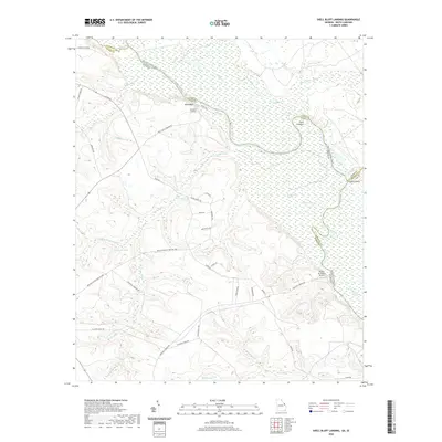
2020 Map of Shell Bluff Landing
USGS Topo · Published 2020About this map
The Savannah River defines the border between Georgia and South Carolina in this 2020 survey, carving a winding path through the lowlands of Burke and Richmond Counties. High ground at Shell Bluff and the nearby Shell Bluff Landing overlook a complex hydraulic landscape of oxbows and wetlands, including Bent Lake and the dense D'Antignac Swamp. This river-bottom environment is dotted with distinct landings and points such as Point Comfort and Flowers Point, markers of the long history of navigation along this stretch of the river.
Find a feature on this map
47 named features on this map. Tap any name to fly to it.
Don’t see what you’re looking for? This feature index may not catch every label — zoom into the map to look around manually.
Map Details
Editions of this 2020 Shell Bluff Landing Map
This is the sole edition of this map. No revisions or reprints were ever made.
Other maps of this area

1920 · Ellenton
USGS Topo · 1:48,000

1920 · Greens Cut
USGS Topo · 1:62,500

1920 · Talatha
USGS Topo · 1:48,000

1921 · Augusta
USGS Topo · 1:62,500

1921 · Talatha
USGS Topo · 1:62,500

1921 · Ellenton
USGS Topo · 1:62,500

1943 · Greens Cut
USGS Topo · 1:62,500

1943 · Augusta East
USGS Topo · 1:125,000

1943 · Talatha
USGS Topo · 1:62,500

1943 · Augusta
USGS Topo · 1:62,500