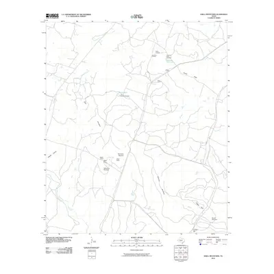
2010 Map of Shell Mountains
USGS Topo · Published 2010About this map
Shell Mountains dominate this Central Texas landscape, defining a topography of gaps and knobs in western Coryell County. The 2010 survey highlights the local prominence of Bushy Knob, Williamson Mountain, and Stampede Mountain, while Royalty Ridge stretches across the northeastern sector. Waterways such as Cowhouse Creek and its tributaries, including Stampede Creek and the curiously named Two Year Old Creek, drain the limestone terrain. Several burial sites, including Spring Hill Cemetery, Walker Cemetery, Bruce Cemetery, and White Cemetery, offer essential points of interest for genealogists and local historians. Recreation and utility are found at Ironhorse Park and Henson Lake, which is contained by the Henson Lake Dam. The presence of Skyline road and F.M. 116 shows the established transportation corridor through these hills.
Find a feature on this map
32 named features on this map. Tap any name to fly to it.
Don’t see what you’re looking for? This feature index may not catch every label — zoom into the map to look around manually.
Map Details
Editions of this 2010 Shell Mountains Map
This is the sole edition of this map. No revisions or reprints were ever made.
Other maps of this area

1894 · Gatesville
USGS Topo · 1:125,000

1930 · Killeen
USGS Topo · 1:62,500

1947 · Fort Hood
USGS Topo · 1:62,500

1947 · Fort Hood
USGS Topo · 1:24,000

1947 · Purmela
USGS Topo · 1:62,500

1947 · Post Oak Mountain
USGS Topo · 1:24,000

1947 · Killeen
USGS Topo · 1:62,500

1947 · Gatesville West
USGS Topo · 1:24,000

1947 · Pidcoke
USGS Topo · 1:24,000

1947 · North Fort Hood
USGS Topo · 1:24,000