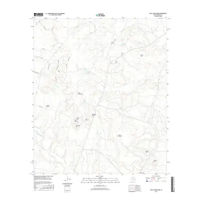
2016 Map of Shell Mountains
USGS Topo · Published 2016About this map
Shell Mountains and the surrounding peaks of Coryell County dominate this 2016 landscape, defining a terrain of prominent ridges and deep hollows like Waddle Hollow. The area is marked by a network of drainage systems, including the notable Cowhouse Creek to the south and Henson Cr which feeds into Henson Lake. This map reveals a pocket of local heritage preserved through several family and community burial sites, such as Walker Cem, Spring Hill Cem, and Bruce Cem. These features, along with names like Royalty Ridge and Stampede Mountain, provide geographic anchors for a region where modern roads like FM 116 and Vista Rd now cut through the traditional cattle and ranching lands of Central Texas. The proximity of Ironhorse Park Lake suggests the intersection of public land use and the natural watershed of Shoal Cr and Turnover Cr.
Find a feature on this map
48 named features on this map. Tap any name to fly to it.
Don’t see what you’re looking for? This feature index may not catch every label — zoom into the map to look around manually.
Map Details
Editions of this 2016 Shell Mountains Map
This is the sole edition of this map. No revisions or reprints were ever made.
Other maps of this area

1894 · Gatesville
USGS Topo · 1:125,000

1930 · Killeen
USGS Topo · 1:62,500

1947 · Fort Hood
USGS Topo · 1:62,500

1947 · Fort Hood
USGS Topo · 1:24,000

1947 · Purmela
USGS Topo · 1:62,500

1947 · Post Oak Mountain
USGS Topo · 1:24,000

1947 · Killeen
USGS Topo · 1:62,500

1947 · Gatesville West
USGS Topo · 1:24,000

1947 · Pidcoke
USGS Topo · 1:24,000

1947 · North Fort Hood
USGS Topo · 1:24,000