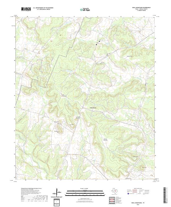
2022 Map of Shell Mountains
USGS Topo · Published 2022About this map
Shell Mountains dominate the central landscape of this Coryell County region, forming a complex of ridges and peaks that includes Stampede Mountain and Williamson Mtn. The terrain is deeply incised by a network of seasonal and perennial waterways, most notably Cowhouse Creek and Henson Cr, which carve through the limestone-rich heights. Evidence of early settlement is preserved in a series of family and community burial grounds, such as Walker Cem and Spring Hill Cem located in the northern reaches, and Elam Cem to the east.
Find a feature on this map
51 named features on this map. Tap any name to fly to it.
Don’t see what you’re looking for? This feature index may not catch every label — zoom into the map to look around manually.
Map Details
Editions of this 2022 Shell Mountains Map
This is the sole edition of this map. No revisions or reprints were ever made.
Other maps of this area

1894 · Gatesville
USGS Topo · 1:125,000

1930 · Killeen
USGS Topo · 1:62,500

1947 · Fort Hood
USGS Topo · 1:62,500

1947 · Fort Hood
USGS Topo · 1:24,000

1947 · Purmela
USGS Topo · 1:62,500

1947 · Post Oak Mountain
USGS Topo · 1:24,000

1947 · Killeen
USGS Topo · 1:62,500

1947 · Gatesville West
USGS Topo · 1:24,000

1947 · Pidcoke
USGS Topo · 1:24,000

1947 · North Fort Hood
USGS Topo · 1:24,000