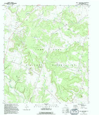
1995 Map of Shell Mountains
USGS Topo · Published 1995About this map
Fort Hood Military Reservation dominates this central Texas landscape, characterized by the prominent uplift of the Shell Mountains and Manning Mountains. The terrain is defined by a series of high ridges and narrow gaps, such as Shell Gap and Graham Gap, which dictate the local drainage patterns of Henson Creek and Cowhouse Creek.
Find a feature on this map
33 named features on this map. Tap any name to fly to it.
Don’t see what you’re looking for? This feature index may not catch every label — zoom into the map to look around manually.
Map Details
Editions of this 1995 Shell Mountains Map
This is the sole edition of this map. No revisions or reprints were ever made.
Other maps of this area

1894 · Gatesville
USGS Topo · 1:125,000

1930 · Killeen
USGS Topo · 1:62,500

1947 · Fort Hood
USGS Topo · 1:62,500

1947 · Fort Hood
USGS Topo · 1:24,000

1947 · Purmela
USGS Topo · 1:62,500

1947 · Post Oak Mountain
USGS Topo · 1:24,000

1947 · Killeen
USGS Topo · 1:62,500

1947 · Gatesville West
USGS Topo · 1:24,000

1947 · Pidcoke
USGS Topo · 1:24,000

1947 · North Fort Hood
USGS Topo · 1:24,000