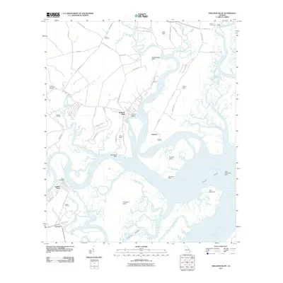
2011 Map of Shellman Bluff
USGS Topo · Published 2011About this map
Shellman Bluff and the winding tributaries of the Julienton River define this coastal landscape in McIntosh County. The area is characterized by a dense network of tidal waterways, including the White Chimney River, Broro River, and Barbour Island River, which navigate around significant landforms like Eagle Neck and Harris Neck. For genealogists, the map is particularly rich in family-named landmarks and burial sites, from the Gould Cemetery near Gould Landing in the north to the Hopkins Cemetery near Crescent in the south. The presence of the Contentment Plantation Cemetery and Sutherland Bluff points to the deep agricultural and maritime history of these Georgia hammocks. This survey also records the path of the Intracoastal Waterway as it passes Creighton Island and Dog Hammock toward Sapelo Sound, illustrating the critical role of these sheltered passages for coastal transit.
Find a feature on this map
64 named features on this map. Tap any name to fly to it.
Don’t see what you’re looking for? This feature index may not catch every label — zoom into the map to look around manually.
Map Details
Editions of this 2011 Shellman Bluff Map
This is the sole edition of this map. No revisions or reprints were ever made.
Other maps of this area

1920 · Sapelo River
USGS Topo · 1:62,500

1920 · Cabretta Island
USGS Topo · 1:62,500

1921 · Darien
USGS Topo · 1:62,500

1928 · St Catherines Island
USGS Topo · 1:62,500

1943 · St Catherines Island
USGS Topo · 1:62,500

1943 · Sapelo River
USGS Topo · 1:62,500

1944 · Cabretta Island
USGS Topo · 1:62,500

1945 · St. Catherine's Island
USGS Topo · 1:62,500

1945 · Sapelo River
USGS Topo · 1:62,500

1946 · Brunswick
USGS Topo · 1:250,000