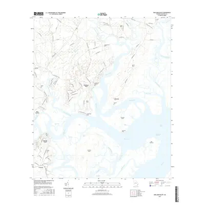
2017 Map of Shellman Bluff
USGS Topo · Published 2017About this map
Bull Town Swamp and the tidal channels of the Julienton River define the intricate landscape of this McIntosh County coastline. The area is characterized by a series of bluffs and necks, including Shellman Bluff, Eagle Neck, and Harris Neck, where upland settlements meet the expansive salt marshes and the Intracoastal Waterway. This survey documents a region deeply rooted in coastal heritage, evidenced by the numerous small burial grounds such as Nelson Cem, Julienton Cem, and Contentment Plantation Cem. To the south, the map follows the winding Sapelo River toward Sapelo Sound, passing significant landforms like Creighton Island and the smaller Dog Hammock. The complex network of cuts and narrows, including Savannah Cut and Creighton Narrows, illustrates the navigational challenges and natural waterways that have shaped local transport and settlement patterns like Pine Harbor and Bellville Point for generations.
Find a feature on this map
94 named features on this map. Tap any name to fly to it.
Don’t see what you’re looking for? This feature index may not catch every label — zoom into the map to look around manually.
Map Details
Editions of this 2017 Shellman Bluff Map
This is the sole edition of this map. No revisions or reprints were ever made.
Other maps of this area

1920 · Sapelo River
USGS Topo · 1:62,500

1920 · Cabretta Island
USGS Topo · 1:62,500

1921 · Darien
USGS Topo · 1:62,500

1928 · St Catherines Island
USGS Topo · 1:62,500

1943 · St Catherines Island
USGS Topo · 1:62,500

1943 · Sapelo River
USGS Topo · 1:62,500

1944 · Cabretta Island
USGS Topo · 1:62,500

1945 · St. Catherine's Island
USGS Topo · 1:62,500

1945 · Sapelo River
USGS Topo · 1:62,500

1946 · Brunswick
USGS Topo · 1:250,000