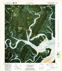
1979 Map of Shellman Bluff
USGS Topo · Published 1979About this map
Shellman Bluff and its riverine surroundings are defined by a complex network of coastal waterways and bluffs in this 1979 orthophotomap. The landscape shows a mix of maritime settlement and protected wetlands, featuring the southern reaches of the Harris Neck National Wildlife Refuge and large tracts like Contentment Plantation. The transition from land to water is detailed with bathymetric soundings and tidal lines, revealing the intricate paths of the Sapelo River, Julienton River, and the Intracoastal Waterway. Local history is anchored by sites like Shellman Bluff Chapel and settlements at Fairhope and Pine Harbor, while the tidal environment is noted as being an area subject to frequent change. This survey provides a precise look at the Georgia coast before further modern development, documenting family-named bluffs and the commercial importance of the Sapelo Sound during the late 1970s.
Find a feature on this map
39 named features on this map. Tap any name to fly to it.
Don’t see what you’re looking for? This feature index may not catch every label — zoom into the map to look around manually.
Map Details
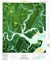
Editions of this 1979 Shellman Bluff Map
2 editions found
Other maps of this area

1920 · Sapelo River
USGS Topo · 1:62,500

1920 · Cabretta Island
USGS Topo · 1:62,500

1921 · Darien
USGS Topo · 1:62,500

1928 · St Catherines Island
USGS Topo · 1:62,500

1943 · St Catherines Island
USGS Topo · 1:62,500

1943 · Sapelo River
USGS Topo · 1:62,500

1944 · Cabretta Island
USGS Topo · 1:62,500

1945 · St. Catherine's Island
USGS Topo · 1:62,500

1945 · Sapelo River
USGS Topo · 1:62,500

1946 · Brunswick
USGS Topo · 1:250,000